Day117(15/Sep/2019) 犬山―中津川(Inuyama-Nakatsugawa)
750発。晴れ。気温25度。今日の名古屋は34度まで上がるらしいが、今は涼しい。今日は途中寄る所もなく、移動日となってしまった。険しい山を登ったり、下ったりすれば、途中には恵那峡(えなきょう)、中津川には苗木(なえぎ)城跡などがあるらしいが、自転車で行くところではない! 皆さん車で行ってください。


今日はずーーと、だらだらとした坂を登って来ました。途中、Day71の松江以来の後輪のパンク! 昔取った杵柄です。焦ることなく、影のある歩道で修理完了。宿で、タイヤチューブの修理。

そして中津川へ。ここは標高300mほどの高原の町です。ルートラボを作っていて気づきましたが、旧中山道も通ってきたようです。

いよいよ明日から本格的な中山道へ! ということで中津川駅到着。

走行距離:69km、通過トンネル:0
ルートラボ(Route Lab)
https://latlonglab.yahoo.co.jp/route/watch?id=3ebba28eb6d341959c5dacb762efe65f
750 departure. Temp:25C. It was still cool. There are several sightseeing spots on the way such as Ena-valley and Naekijo Castle site from WEB photos. In order to reach them, I should climb the mountains. I didn’t have any energy to visit them.
On the way, I found that the rear tire went flat. The puncture was after Day71 in Matsue. I was not in a panic and replaced the tube without any problems. In the night, I repaired the tube which had a small hole.
I could see the city of Nakatsugawa from the hill. The city locates at the sea level of 300m. And finally, I arrived the Nakatsugawa Station.
Today’s mileage:69km, tunnel passed:0
Day116(14/Sep/2019) 桑名―犬山(Kuwana-Inuyama)
(English is available after Japanese.)
815発。曇り。気温24度。涼しい。揖斐川(いびがわ)沿いの道を北上する。10Kmほどさかのぼると、丁度三重、愛知、岐阜の県境の地点に国営木曽三川公園(住所は岐阜)があり、高い塔が立っていた。

930開園ということで15分くらい待って入る。さて、木曽三川(きそさんせん)とは何ぞや? はい、木曽川、長良川、揖斐川(いびがわ)です。ちょどその三つの川が、この辺りに集まってきています。早速、塔に登ってみました。私一人です。素晴らしい長めです。


この大きな三つの川よって造られたのが濃尾平野(美濃と尾張)です。昔から川の氾濫による被害が多く発生しました。この辺りの土地は江戸時代から治水との戦いでした。丁度60年前の9月の伊勢湾台風もこの三つの川の上流に大雨を降らせたため、洪水により甚大なる被害をもたらしました。
公園に咲いていた朝顔?があまりにも奇麗だったので、おすそわけです。

公園を後にし、ひたすら犬山市へ。写真で知っている犬山城がいかにりりしいか! 川沿いの高い山の頂上に、国宝犬山城が鎮座している。したのイメージです。この目で確かめないわけにはいかない!

「Wow! 何と幸運な事か!」 修復中でした。普通の城だったら、いつでも見れます。修復中の城なんて何十年に一回しか見れないのです。これも熊野三山のお導きか!


やはり、川沿い(木曽川)に立つ犬山城を見なければ! やっぱり修復中でした。高い山を想像して、天守閣まではケーブルカーか何かで行くのかな?と思っていたら、そんなの必要なく、低い山でした。


しかし、国宝ですよ、国宝。今回の旅で、国宝の城を見るのは、松江城、姫路城、そしてこの犬山城と三つ目です。城下町の一角は、埼玉の川越のようなレトロな雰囲気の土産物屋、食べ物屋通りになっていた。

連休初日で観光客も沢山いた。ガンバレ犬山!
走行距離:67km、通過トンネル:1
ルートラボ(Route Lab)
https://latlonglab.yahoo.co.jp/route/watch?id=3887313b298b8ae1d83b1324d3b63823
815 departure. Temp:24C. It was cloudy and cool. I moved along the Ibigawa river and arrived “The National Kiso Three Rivers Park” at the point of borders of 3 prefectures (Gifu, Mie and Aichi). What are the three rivers? They are Kisogawa river, Nagaragawa river and Ibigawa river. These three rivers get together here. There was a tower in the park, and I went up. The scenery from the top of tower was beautiful. I could see three rivers were getting together here. Due to the concentration of these big rivers in this area, there were a lot of river disasters by floods historically. Since Edo period, the river management has been the most important issue in this area.
I found beautiful flowers of morning glory. I want to share with you.
After the part, I just went on to Inuyama city. There is a national treasure, “Inuyama Castle”. I knew from the photo. The castle located on the high mountain and there was a beautiful river below the mountain. How was the reality? Very fortunately, the castle was under repair. We could see the normal castle anytime, but it was very rare to see the castle under repair!!!!! I was very lucky! How was the view from the river? Yes, it was under repair! The mountain was also not so high. Anyway, this is a national treasure.
In front of the castle, there was an old-style street. In the street, there are many souvenirs and snack shops. There were many tourists today thanks to the first day of three consecutive holidays.
Today’s mileage:67km, tunnel passed:1
Day115(13/Sep/2019) 多気―桑名(Taki-Kuwana)
(English is available after Japanese.)
今日の天気予報は雨。昨日泊った南の尾鷲では雨が降っているらしい。北に位置するここはまだ降っていない。降らないうちにできるだけ先に進もう。820分発。暗―い曇り。気温25度。出発すると、いきなりポツポツ始まった。ホテルに戻ろうかとも思ったが、困った時の神頼み。「熊野三山の神様。頼みますから宿に着くまで雨を降らさないで!」とお願いした。いつ降り出してもおかしくない空模様だ。
松阪市に入って、「ええー!」と驚く看板を見つけた。ある人の記念館だ。これは行かなきゃいけないでしょう。この人の記念館でした。

そう松浦武四郎です。Day41に登場した「北海道」を命名した人。7月15日の松潤のドラマの人(このドラマ自体は駄作でしたが。。)。そう、あの武ちゃんの出身地が松阪だったのです。1830年の「文政のおかげ参り(特別な伊勢参り)」の時に武ちゃんは13歳。その「おかげ参り」には半年で400万人以上の人々が、ここ松阪を通ってお伊勢参りに押し掛けたそうです。それを見ていた武ちゃんは外の世界を見たいと強く思うようになり、16歳で家出して旅へ。17歳から本格的に日本全国を歩きました。北海道に行く前には、すでに本州、九州、四国もすべて踏破しています。26歳から6回北海道や樺太、千島列島など探索して、北海道内陸部の地名までついた詳細な地図ができあがりました。

松前藩や商人たちがアイヌの人たちに悪業の限りを尽くしているといった本を出そうとしましたが、松前藩などからの圧力で出版できたのは彼の死後でした。ここ松阪で松浦武四郎に再会するとは思わなかった!これは、彼から私への何かのメッセージか?
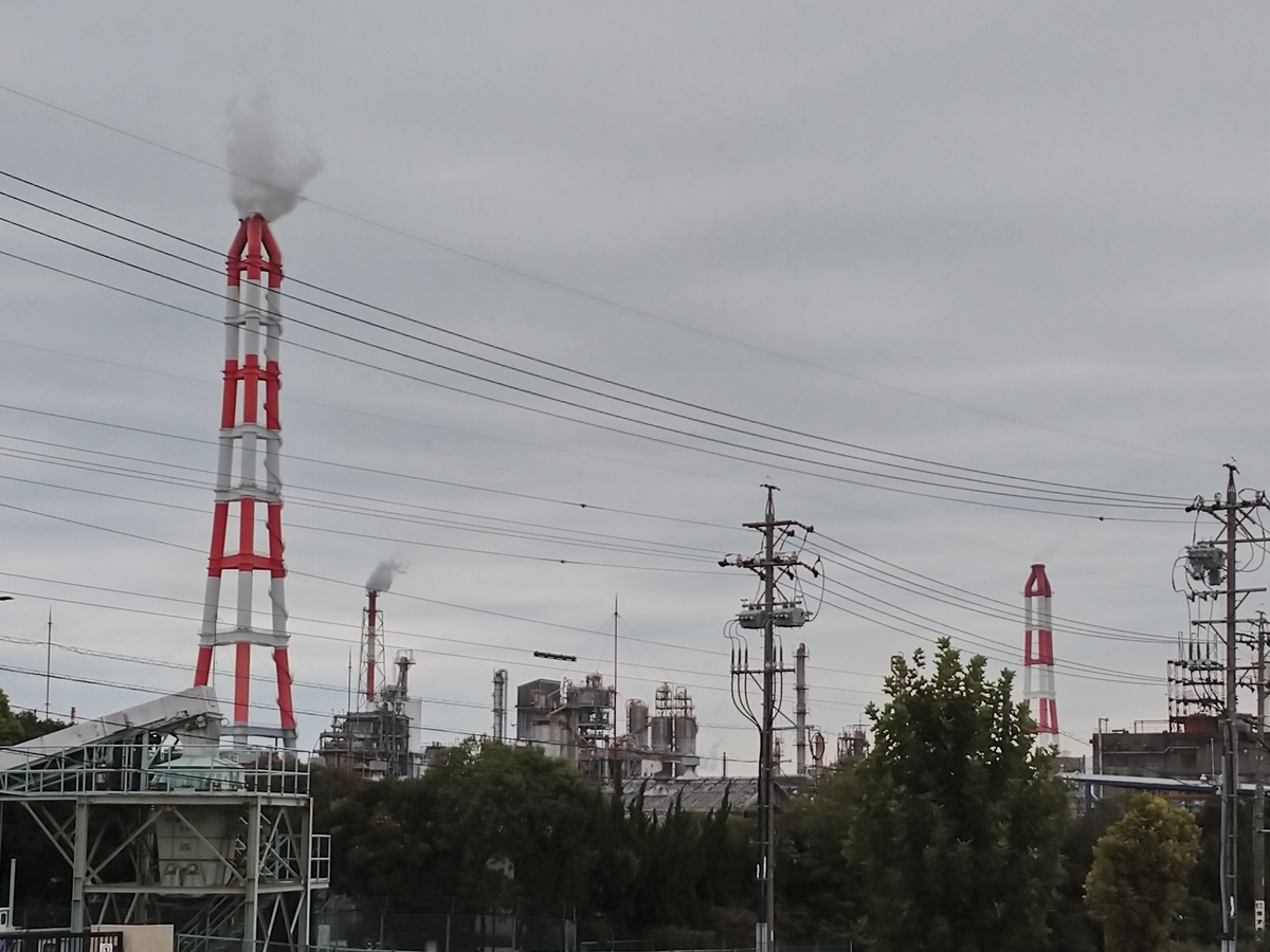
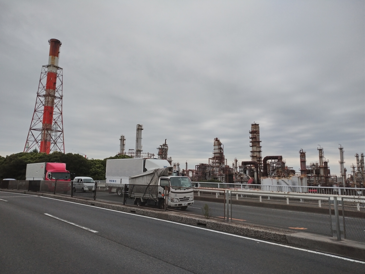
四日市工業地帯を通ると、大きな煙突群とトラックの走る数に圧倒される。躍動日本!という感じです。


この旅の中で「日本の土台は現場で制服を着て汗を流している人たちによって支えられているんだ」とつくづく感じています。現在の千葉での復旧作業もそうです。頭が下がります。
そうこうしているうちに「その手は桑名の焼き蛤」に到着。桑名駅は改築中でした。

で、雨はどうなったか? 熊野三山のご加護で、雨は降らずメデタシ、メデタシ。ありがとう熊野三山様。年末ジャンボもよろしくお願いします。
走行距離:76km、通過トンネル:0
ルートラボ(Route Lab)
https://latlonglab.yahoo.co.jp/route/watch?id=3205c72aa970dfa57672d1510cc669a5
According to the weather forecast, it would rain today. It was raining this morning in Owase, where I stayed yesterday. I wanted to move as far as possible before the rain started. 820departure. Temp:25C. When I started, the very light rain began. I prayed to Gods of Kumano Sanzan not to rain.
In Matsuzaka city, I was surprised to find the sign board for someone’s memorial museum. He was Takeshiro Matsuura who named “Hokkaido”. I introduced him on Day41 in Hokkaido. After 70days, I met him again here. It was unbelievable.
In 1830, there was a big boom of pilgrims to Ise Jingu shrine. More than 4mill people visited to the shrine through Matsuzaka city. At that time, Takeshiro was 13 years old in this city. He was influenced by the people from outside and he himself wanted to see the outside eagerly. He started to walk around all over Japan from age17. He almost completed to visit Japan except for Hokkaido before age 26. After that, he started to visit Hokkaido at year 26. He visited 6 times totally and walked everywhere. He made the very detailed map of Hokkaido with names of places and the report about local domain’s evil deeds against original inhabitants. Unfortunately, this report was not in public before he died.
In Yokkaichi-city, there was an industrial area. There were big chimneys and a lot of trucks were passing on the road. The base of industry in Japan was made by physical works with uniforms and a lot of sweats.
Finally, I arrived Kuwana station. Thanks to Gods, it didn’t rain today.
Today’s mileage: 76km, tunnel passed:0
Day114(12/Sep/2019) 尾鷲(おわせ)-多気(Owase-Taki)
(English is available after Japanese.)
自転車に空気を入れ750発。快晴。27度。出発していきなり登り。ここ尾鷲はDay100の宇和島に似ている。三方を山に囲まれ、平坦な出口は海のみ。入るのも出るのも山を登らなければならない。最初の峠を越して下って行くと、驚くほど透き通った川があった。後で調べたら「奇跡の清流 銚子川」だった。やはり有名な川だったんだ!

山を進んでいるもんだと思ったら、いきなり海。紀北町の海がキラキラしていた。

そして、二つ目の峠。荷坂峠という所。今日も、よくここまでひーひー言いながら登ってきたもんだ。遠くに海が見える。

今日は二つの峠で終わりだと思ったら、「こわっぱ」的な坂が最後まで続いた。峠の後は、ただただ下りにしてもらいたいもんだ。宮川の流れが、面白い形に土地を削っていた。

今日は多気町まで。
走行距離:80km、通過トンネル:3
ルートラボ(Route Lab)
https://latlonglab.yahoo.co.jp/route/watch?id=059e49b1255cd19947ad199415192f0d
750 departure. Temp:27C. As soon as I started, the scent also began. The landscape of Owase city was very similar to Uwajima city of Day100. Both cities were surrounded by steep mountains and sea. In order to come/go, I should cross the pass. After I crossed the first pass, I encountered the stream with very transparent water. I could see the bottom of stream. After I checked, I knew that this stream was “Choshigawa river” and it was very famous for transparent water.
After this river, the sea appeared though I had thought I was moving in the mountain area. The sea was shining in the morning sun.
I reached the second pass, “Nisaka Pass” after I struggled to move. I could see the sea down below.
Before I arrived today’s destination, I found the interesting shaped-land carved by streams.
Today’s destination was Taki town.
Today’s mileage:80km, tunnels passed:3
Day113(11/Sep/2019) 新宮―熊野那智大社―尾鷲(おわせ)(Shingu-Kumano Nachi Taisha-Owase)
(English is available after Japanese.)
新宮まで来たなら、やはり那智大滝を見ないで通り過ぎるわけには行かない。「那智の滝を見ずしてケッコウと言うなかれ!」だ。進む方向が逆になるので、ここは7時前の新宮発の電車とバスを乗り継いで那智大滝へ。8時前には大滝に到着。


まだ観光客が到着する前だったので、私一人で独占。荘厳、華麗、静寂の中の滝の音。青い空と相まって、神々しい姿。これが那智大滝か! 感動したので、「那智の滝づくし」をお届けします。


ここまで来たら、熊野三山の最後の一つ、熊野那智大社にお参りしないわけにはいかない。滝から坂を1kmほど上ります。巡礼ではここが最後だったらしいが、最後が一番きつい。しかも昔の人達はバスでは来ない!


そこからの三重塔を入れた那智の大滝の眺めは、これまた素晴らしい! やはりここに来て、極楽浄土と思ってしまうのはよくわかる。


今回、図らずしも熊野三山にお参りすることができた。心から、いろいろな願い事がかなうようお祈りしました。神様はかなえてくれるでしょう。よろしくお願いします、熊野三山の神様!!
そこから新宮に引き返して10時半出発。気温31度。今日も暑い! まあ願い事がかなうので暑さもへっちゃらだ! 川を渡るともう三重県。途中「道の駅 うみがめ公園」というところで、「うみがめ」を見て、海沿いの「獅子岩」を写真にとり、軽快に進んでいました。


軽快だったのはそこまで。それから修行の山登りが始まりました。何回も休みながら、何回も押しながら、ひーひー言いながら、「いつまで続く登り坂」と一時間以上格闘して、やっとトンネル。今日の標高は330mほどでした。尾鷲(おわせ)に着くと、やはりあったよ「中部電力 尾鷲発電所」。という事で尾鷲駅も訪問。


走行距離:60km、通過トンネル:5つ
ルートラボ(Route Lab)
https://latlonglab.yahoo.co.jp/route/watch?id=ee0734639670c4a27c2e9980bdc4a565
After I left my stuff, I went to see “Nachi Waterfall” by train/bus. This is one of most famous waterfalls in Japan. Thanks to the weather and less people, I could feel the magnificence and splendor of this waterfall. I was really impressed. I can show you several beatiful photos.
Close to this waterfall, there was one of Kumano Shrines, “Kumano Nachi Taisha”. Taking this opportunity, I visited this shrine too. During the ancient pilgrim time, this shrine was the final destination. Although it was last, it was toughest to visit.
The view of waterfall with the three-storied pagoda from this shrine was beautiful. I could imagine that the ancient people believed this place was heaven, too.
After I came back to my inn, I restarted my journey at 1030am. Temp:31C. It was hot.
On the way, there was “Road Station, Turtle Park”. I could see the turtle in the seawater pool. And “Lion Rock” was at the coast of Mie prefecture. Up to here, I could enjoy the cycling.
After that, the ascent continued, continued and continued. I had many breaks and I pushed it many times. It was tough!
Finally, I arrived Owase city. The power plant of Chubu Electric Power company welcomed me at the entrance of the city. I visited Owase station too as usual.
Today’s mileage:60km, tunnels passed:5
Day112(10/Sep/2019) 中辺路(なかへち)-熊野本宮―新宮(Nakahechi-Kumano Hongu-Shingu)
(English is available after Japanese.)
熊野古道は外国人に大変人気のようだ。昨晩の民宿は総勢7人。私以外はすべて外国人で、オーストラリア、カナダ、台湾と国もいろいろ。今朝出発する時は、すでに誰もいなかった。涼しいうちに歩き始めるらしい。750発。25度。いきなり登りが始まった。昨日は中辺路で止めておいて良かった! この国道311号線の名前が”Kumano Roman Road”になっているけど、これだと「ローマ人の道」じゃないの? 「熊野いにしえ街道」で ”Kumano Ancient Road”に改名希望!

40分ひたすら登り続けやっとトンネルを通り下りになった。こんな所を走っています。


下りはラクチン。いくつものトンネルを抜けていきなり熊野川にぶつかりました。そのぶつかった景色が写真。

熊野古道の山道を、苦労に苦労を重ねて歩いた後にこれを見たら、「こここそが極楽浄土の地だ!」と思っただろうなと容易に想像できます(ブラタモリの受け売り)。深く暗い山道と、明るく開けた空間があまりにも違い過ぎる。
熊野本宮大社の元あった場所(大斎原、おおゆのはら)から河原を写すと、下の写真になります。とても河原が広い!


1889年の大洪水で熊野本宮大社は壊滅的な被害を受け、山の中腹に移転しました。それまでも何度も水害に遭い建て替えられてきたという歴史があります。その大斎原(おおゆのはら)には、日本一大きな鳥居がすごい存在感で立っています。

その鳥居には八咫烏(やたがらす)のマークが。日本にサッカーを紹介した人物が熊野那智大社の近くの出身だったので、1987年からサッカー日本代表チームのマーク使われるようになったらしい。

山に移転した熊野本宮大社の最初の鳥居と上の入り口です。中は撮影禁止です。


熊野本宮大社にお参りすると、「新しい人生」が開けるとの事。さあ~~私の新しい人生はどのようになるんだろう? 立派な大人になりたいものです。

熊野本宮から新宮までは、熊野川にそって下るのみ。もちろん少しのアップダウンはあるが、まあそれも愛嬌。川に沿って下るというのは大変気分がいい。かつ、この熊野川の風景が天気のせいもあるが、すばらしかった!ちょっとオマケで入れておきます。


新宮到着。ここには熊野三山のひとつ熊野速玉大社(くまのはやたまたいしゃ)があります。せっかくなので訪問。

昔の人達は本宮大社からここまで熊野川を船で下ってきたとの事。ということで新宮駅。

走行距離:66km、通過トンネル:14
ルートラボ(Route Lab)
https://latlonglab.yahoo.co.jp/route/watch?id=2fe387d4428b00f1e10ad62f1e6358b8
Walking on Kumano Kodo must become very popular for foreiners. In the inn last night, 6 out of 7 guests were foreigners. They were from Australia, Canada and Taiwan. When I left this morning, they all already had gone. They liked to walk during the cooler time.
750departure. Temp:25C. The ascent road started immediately, and it continued for 40mins.The nick name of this road was “Kumano Roman Road”. It looked like “Roman people’s road”. It should be changed to “Kumano Ancient Road”.
After the tunnel at the peak, I was pedaling in the deep mountains. However, it was an easy job to move on the descent road. After passing through several tunnels, I encountered Kumano River and Huge river beach with open air. I could easily imagine that the ancient people who had walked/struggled on Kumano Kodo in the deep mountains were surprised to see this huge open space. They must believe this was a heaven.
2 photos were river beaches from the place of the original Kumano Hongu Taisha Shrine. In 1889, the very heavy flood destroyed the shrine and it moved to the middle of mountain. At the original place, there was the biggest torii gate in Japan. The symbol of this shrine, “Crow with tree legs”, was on torii gate.
There are two photos of the first gate of the current Kumano Hongu Taisha shrine and 2nd one.
From Kumano Hongu to Shingu city, the road was descent. It was easy job to move along with the Kumano river. The sceneries of Kumano river were so beautiful thanks to the weather. I put several beautiful ones as compliments.
In Shingu city, I visited Kumano Hayatama Shrine which was one of Kumano tree shrines. The ancient people visited here from Hongu Taisha by the boat on Kumano river.
Finally, I arrived Shingu Station.
Today’s mileage:66km, tunnels passed:14
Day111(9/Sep/2019) 印南(いなみ)-紀伊田辺―中辺路(なかへち)(Inami-KiiTanabe-Nakahechi)
(English is available after Japanese.)
800発。27度。関東は台風15号で大変だったようだが、こちらは真夏のカンカン照り天気。出発してすぐの、みなべ町の海がきれいだった。このあたりから梅干し商品の看板が目立つ。
1時間半で紀伊田辺に到着。観光案内所を覗いたら、すぐ近くに「闘鶏神社」という世界遺産がある。創建は419年と熊野三山の別館的意味合いで建てられた由緒正しい宮。


時は過ぎ源平合戦の折り、このあたりを統括していたのが武蔵坊弁慶の父で熊野水軍の首領でもあった湛増(たんぞう)オヤジ。源氏(白)に付くか平家(赤)に付くか闘鶏で占ったところ、七匹すべての白の鶏が赤の鶏に勝ち、オヤジは源氏に付くこととなり、ご存知のように結果は源氏の方に軍配が上がった。それ以来、ここは闘鶏神社と言われるようになったらしい。

紀伊田辺を少し南下して、そこから富田川に沿って内陸部に。途中川に降りられるところがあったが、水はものすごく透明で、すぐにでも飛び込みたい気分。


途中、熊野古道が山道として本格的に始まる場所に滝尻王子というお社がありました。「王子」とは熊野の神様の御子神(みこがみ)がまつられているところで、参詣者の休憩所でもあったとの事。折角なので、熊野古道をちょっと歩いてみたけど、かなり険しい。


今日は、かなり高い所まで登るから距離は短めにした。途中、もうちょっと行けたかな~思っていたが、最後の10kmがきつかった。熊野をなめてはいけません。
走行距離:62km、通過トンネル:5
ルートラボ(Route Lab)
https://latlonglab.yahoo.co.jp/route/watch?id=5643341c36cf702a394b02616a05b365
800 departure. Temp:27C. It was very fine day though the area of Kantoh was hit by typhoon #15. I could see the beautiful ocean at Minabe town. There were a lot of signboards of “Pickled Plum” from this town onward.
After 1.5 hours, I arrived KiiTanabe city. In the tourist center, I found the World Heritage Shrine, “Toukei Shrine”, and I went there. It was established in AD419 as a kind of branch of Kumano Shrine. In late 12C, the shrine divined the result of domestic battles by cockfights. After that, this shrine has been called as Tokei (Cockfight).
After KiiTanebe, I moved up along Tomita river. At the point of upstream, the water was very transparent and clean.
I arrived the place of Takizawa Ohji”, where was the starting point of traditional “Kumano Kodo (Kumano Ancient Pass)”. I tried to walk a little and found that it was very steep and tough.
Today’s mileage was relatively shorter. I had been thinking I could go further today. However, for the last 10km, it was very tough to pedal. It was a good idea to stop here today.
Today’s mileage:62km, tunnels passed:5